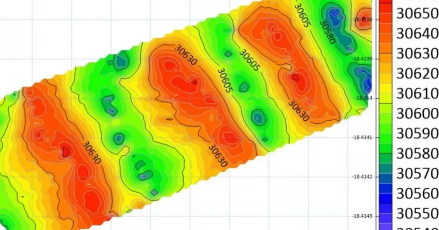
A magnetic field intensity map for a local area is used in geological and mineral exploration to detect subsurface features. These maps are created using magnetometer readings taken systematically over a grid.
The supply from the standard in addition to customized construction products have brought towards the development of property sector in addition to various allied sectors. Furthermore, consistent development and research is built to provide using the most suitable products.
The supply from the standard in addition to customized construction products have brought towards the development of property sector in addition to various allied sectors. Furthermore, consistent development and research is built to provide using the most suitable products.
The supply from the standard in addition to customized construction products have brought towards the development of property sector in addition to various allied sectors. Furthermore, consistent development and research is built to provide using the most suitable products.
The supply from the standard in addition to customized construction products have brought towards the development of property sector in addition to various allied sectors. Furthermore, consistent development and research is built to provide using the most suitable products.
The supply from the standard in addition to customized construction products have brought towards the development of property sector in addition to various allied sectors. Furthermore, consistent development and research is built to provide using the most suitable products.
The supply from the standard in addition to customized construction products have brought towards the development of property sector in addition to various allied sectors. Furthermore, consistent development and research is built to provide using the most suitable products.
The supply from the standard in addition to customized construction products have brought towards the development of property sector in addition to various allied sectors. Furthermore, consistent development and research is built to provide using the most suitable products.
The supply from the standard in addition to customized construction products have brought towards the development of property sector in addition to various allied sectors. Furthermore, consistent development and research is built to provide using the most suitable products.